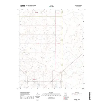
2023 Map of Doyle Hill
USGS Topo · Published 2023About this map
Nara Visa sits at the southwestern edge of this landscape, marking a sparse ranching and rail-stop territory near the High Plains borderlands. The terrain is defined by the ephemeral drainage patterns of the East Fork Nara Visa Arroyo and North Fork Horse Creek, which carve through the southern portion of the quadrangle. To the north, the elevation rises toward the prominent Doyle Hill and the neighboring Holaday Hill, while the eastern margin is characterized by the undulating Sand Hills. This area straddles the significant geopolitical boundary where New Mexico meets Texas, a line that also marks the intersection of Quay Co, Union Co, and Hartley Co. The network of local routes, including Bell ST and Quay RD, connects isolated water features like Snyder Lake and Dirt Tank, reflecting the logistical challenges of land management in this arid cattle-country environment.
Find a feature on this map
26 named features on this map. Tap any name to fly to it.
Don’t see what you’re looking for? This feature index may not catch every label — zoom into the map to look around manually.
Map Details
Editions of this 2023 Doyle Hill Map
This is the sole edition of this map. No revisions or reprints were ever made.
Other maps of this area

1954 · Tucumcari
USGS Topo · 1:250,000

1958 · Tucumcari
USGS Topo · 1:250,000

1971 · Kerlin Hill
USGS Topo · 1:24,000

1971 · Centerville Corner
USGS Topo · 1:24,000

1971 · Doyle Hill
USGS Topo · 1:24,000

1971 · Amistad SE
USGS Topo · 1:24,000

1971 · Obar
USGS Topo · 1:24,000

1971 · Nara Visa
USGS Topo · 1:24,000

1971 · Whiteaker Ranch
USGS Topo · 1:24,000

1971 · Knoblaw
USGS Topo · 1:24,000