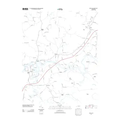
2013 Map of Doyle
USGS Topo · Published 2013About this map
Caney Fork and the Rocky River dominate this Central Tennessee landscape, where water has shaped both the topography and the settlement patterns. The confluence of these waterways near Rock Island highlights a region defined by its river-bound communities, including the village of Walling and the nearby Quebeck. Further south, the map details the community of Bone Cave, situated near the base of Bone Cave Mountain, a name that hints at the significant geological and cavernous features common to this portion of the Cumberland Plateau.
Find a feature on this map
153 named features on this map. Tap any name to fly to it.
Don’t see what you’re looking for? This feature index may not catch every label — zoom into the map to look around manually.
Map Details
Editions of this 2013 Doyle Map
This is the sole edition of this map. No revisions or reprints were ever made.
Other maps of this area

1892 · Pikeville
USGS Topo · 1:125,000

1893 · Mc Minnville
USGS Topo · 1:125,000

1895 · Mc Minnville
USGS Topo · 1:125,000

1895 · Pikeville
USGS Topo · 1:125,000

1943 · Cookeville
USGS Topo · 1:100,000

1944 · Cookeville
USGS Topo · 1:100,000

1953 · Chattanooga
USGS Topo · 1:250,000

1954 · Sparta
USGS Topo · 1:24,000
1954 · Spencer
USGS Topo · 1:24,000
1956 · Bald Knob
USGS Topo · 1:24,000