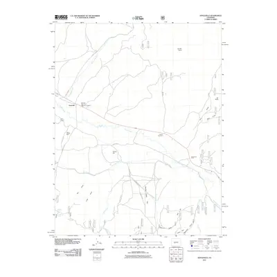
2011 Map of Doyleville
USGS Topo · Published 2011About this map
Tomichi Dome anchors the high country of Gunnison County in this 2011 survey, overlooking a valley defined by ranching and historic water management. The settlement of Doyleville serves as a central point for the local community, supported by agricultural lifelines like the Arch Irrigation Ditch and Needle Creek Ditch. Genealogists will find the Doyleville Cemetery and Doyle Cemetery situated near Monson Gulch, providing clear evidence of early family ties to this landscape. The presence of the Moore Property Mine near County Rd 45 points to the region's mining history, while contemporary livestock operations are represented by the Pleasant View Ranch and Double Heart Ranch. The map also captures several natural water sources such as Beer Keg Spring and Willow Bog Spring, which have long been essential for both wildlife and ranching in this high-altitude terrain.
Find a feature on this map
38 named features on this map. Tap any name to fly to it.
Don’t see what you’re looking for? This feature index may not catch every label — zoom into the map to look around manually.
Map Details
Editions of this 2011 Doyleville Map
This is the sole edition of this map. No revisions or reprints were ever made.
Other maps of this area

1940 · Garfield
USGS Topo · 1:62,500

1941 · Pitkin
USGS Topo · 1:62,500

1945 · Pitkin
USGS Topo · 1:62,500

1945 · Garfield
USGS Topo · 1:62,500

1956 · Montrose
USGS Topo · 1:250,000

1959 · Montrose
USGS Topo · 1:250,000

1960 · Montrose
USGS Topo · 1:250,000

1962 · Doyleville
USGS Topo · 1:24,000

1962 · West Baldy
USGS Topo · 1:24,000

1962 · Houston Gulch
USGS Topo · 1:24,000