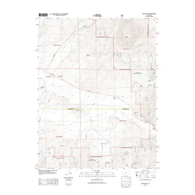
2013 Map of Doyleville
USGS Topo · Published 2013About this map
Tomichi Creek winds through this high-altitude landscape, anchoring the settlement of Doyleville and several nearby working lands. The presence of both Doyleville Cem Number 1 and Doyleville Cem Number 2 provides significant touchpoints for genealogists tracing early families in this corner of the Gunnison National Forest. The map captures a high-country ranching and irrigation system, evidenced by the Arch Irrigation Ditch and Needle Creek Ditch that feed into the local creek network. Dominating the northeastern terrain is the massive Tomichi Dome, rising above a series of named gulches including Monson Gulch and Berry Gulch. This 2013 survey illustrates the continued importance of US Highway 50 as the primary artery connecting these remote ranching operations, such as Pleasant View Ranch and Double Heart Ranch, with the broader region across the Gunnison and Saguache county line.
Find a feature on this map
47 named features on this map. Tap any name to fly to it.
Don’t see what you’re looking for? This feature index may not catch every label — zoom into the map to look around manually.
Map Details
Editions of this 2013 Doyleville Map
This is the sole edition of this map. No revisions or reprints were ever made.
Other maps of this area

1940 · Garfield
USGS Topo · 1:62,500

1941 · Pitkin
USGS Topo · 1:62,500

1945 · Pitkin
USGS Topo · 1:62,500

1945 · Garfield
USGS Topo · 1:62,500

1956 · Montrose
USGS Topo · 1:250,000

1959 · Montrose
USGS Topo · 1:250,000

1960 · Montrose
USGS Topo · 1:250,000

1962 · Doyleville
USGS Topo · 1:24,000

1962 · West Baldy
USGS Topo · 1:24,000

1962 · Houston Gulch
USGS Topo · 1:24,000