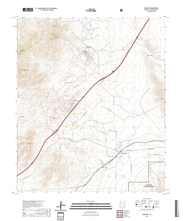
2021 Map of Dragoon
USGS Topo · Published 2021About this map
Little Dragoon Mountains dominate the northwestern landscape of this Cochise County quadrangle, where high desert peaks and steep canyons overlook the settlement of Dragoon. The area is defined by its topographic extremes, from the heights of Lime Peak and the Mae West Peaks down to the arid courses of Dragoon Wash and Sheep Wash. The central corridor is a major transportation artery, with Interstate 10 crossing through Texas Summit and Dragoon Pass, mirroring the path of the southern rail line. To the north, the historic mining area of Johnson sits at the foot of the mountains. The southern edge of the map reaches into the Coronado National Forest, where the terrain transitions into the Gunnison Hills and Wood Canyon. This modern survey reveals a landscape of working ranches and remote peaks connected by named routes like Russellville Rd and S XC Bar Ranch Rd.
Find a feature on this map
49 named features on this map. Tap any name to fly to it.
Don’t see what you’re looking for? This feature index may not catch every label — zoom into the map to look around manually.
Map Details
Editions of this 2021 Dragoon Map
This is the sole edition of this map. No revisions or reprints were ever made.
Other maps of this area

1915 · Benson
USGS Topo · 1:125,000

1916 · Pearce
USGS Topo · 1:125,000

1922 · Willcox
USGS Topo · 1:125,000

1922 · St. David
USGS Topo · 1:62,500

1926 · Courtland
USGS Topo · 1:62,500

1943 · Benson
USGS Topo · 1:125,000

1943 · Cochise
USGS Topo · 1:62,500

1943 · Dragoon
USGS Topo · 1:62,500

1954 · Silver City
USGS Topo · 1:250,000

1955 · Douglas
USGS Topo · 1:250,000