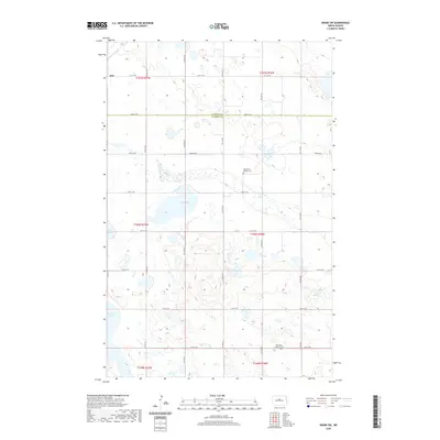
2020 Map of Drake SW
USGS Topo · Published 2020About this map
Kief serves as the primary settlement anchor in this corner of North Dakota, situated on the border between McHenry and Sheridan counties. The landscape is defined by the prairie pothole region's characteristic topography, featuring numerous water bodies including Kandt Lake, Krueger Lake, and Ebel Lake. This 2020 survey documents a rural agricultural grid defined by local routes such as 31st ST Ne and 24th ST Ne. The map is particularly useful for genealogical research, identifying specific community markers like the Rosenfeld Baptist Cemetery and Saint Peter Lutheran Cemetery, which represent the enduring spiritual and social centers of the region's homesteading families.
Find a feature on this map
23 named features on this map. Tap any name to fly to it.
Don’t see what you’re looking for? This feature index may not catch every label — zoom into the map to look around manually.
Map Details
Editions of this 2020 Drake SW Map
This is the sole edition of this map. No revisions or reprints were ever made.
Other maps of this area

1929 · Balfour
USGS Topo · 1:62,500

1930 · Drake
USGS Topo · 1:62,500

1945 · Pelican Lake
USGS Topo · 1:62,500

1947 · Pelican Lake
USGS Topo · 1:62,500

1947 · Lincoln Valley
USGS Topo · 1:62,500

1954 · McClusky
USGS Topo · 1:250,000

1958 · McClusky
USGS Topo · 1:250,000

1958 · Drake
USGS Topo · 1:62,500

1958 · Balfour
USGS Topo · 1:62,500
1958 · Drake SW
USGS Topo · 1:24,000