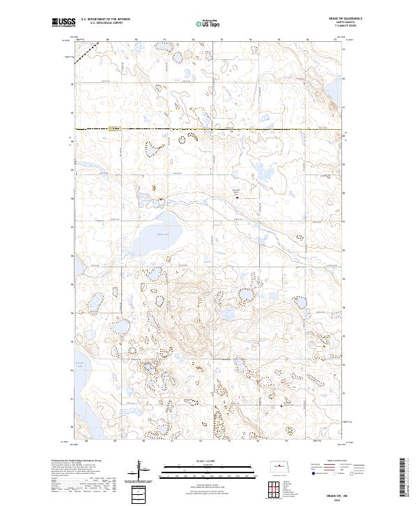
2024 Map of Drake SW
USGS Topo · Published 2024About this map
Sheridan County and the southern edge of McHenry County converge in this section of the Prairie Pothole Region, where the landscape is defined by countless small wetlands and seasonal basins. The Sheridan County Waterfowl Production Area dominates the central terrain, preserving the vital habitat surrounding Kandt Lake. This map reveals a high-plains landscape organized by a rigid grid of gravel roads, from 31st St NE in the north to 24th St NE in the south, reflecting the enduring legacy of the Public Land Survey System. For those tracing the heritage of the local farming community, two key landmarks stand as anchors of the rural social fabric: Rosenfeld Baptist Cem near the center of the sheet and Saint Peter Lutheran Cem further south, each representing the foundational church communities of the early twentieth century.
Find a feature on this map
22 named features on this map. Tap any name to fly to it.
Don’t see what you’re looking for? This feature index may not catch every label — zoom into the map to look around manually.
Map Details
Editions of this 2024 Drake SW Map
This is the sole edition of this map. No revisions or reprints were ever made.
Other maps of this area

1929 · Balfour
USGS Topo · 1:62,500

1930 · Drake
USGS Topo · 1:62,500

1945 · Pelican Lake
USGS Topo · 1:62,500

1947 · Pelican Lake
USGS Topo · 1:62,500

1947 · Lincoln Valley
USGS Topo · 1:62,500

1954 · McClusky
USGS Topo · 1:250,000

1958 · McClusky
USGS Topo · 1:250,000

1958 · Drake
USGS Topo · 1:62,500

1958 · Balfour
USGS Topo · 1:62,500
1958 · Drake SW
USGS Topo · 1:24,000