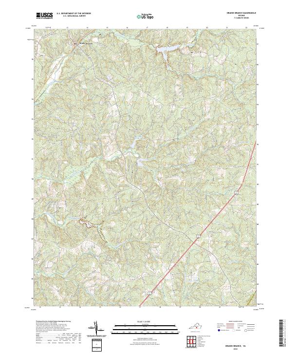
2022 Map of Drakes Branch
USGS Topo · Published 2022About this map
Drakes Branch serves as the primary hub of this Southside Virginia landscape, situated where local roads like Proctor St and Main St converge. The topography is defined by an intricate network of waterways, including Twittys Cr, Horsepen Cr, and the S Meherrin River. These streams are punctuated by managed water features such as Roanoke Cr Site 51a Lake and Roanoke Cr Site 49a Lake, reflecting modern land and water management practices in Charlotte County.
Find a feature on this map
83 named features on this map. Tap any name to fly to it.
Don’t see what you’re looking for? This feature index may not catch every label — zoom into the map to look around manually.
Map Details
Editions of this 2022 Drakes Branch Map
This is the sole edition of this map. No revisions or reprints were ever made.
Other maps of this area

1891 · Farmville
USGS Topo · 1:125,000

1892 · Appomattox
USGS Topo · 1:125,000

1893 · Farmville
USGS Topo · 1:125,000

1947 · Roanoke
USGS Topo · 1:250,000

1953 · Greensboro
USGS Topo · 1:250,000

1954 · Greensboro
USGS Topo · 1:250,000

1954 · Clover
USGS Topo · 1:62,500

1955 · Chase City
USGS Topo · 1:62,500

1956 · Charlotte Court House
USGS Topo · 1:62,500

1958 · Keysville
USGS Topo · 1:62,500