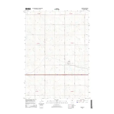
2015 Map of Draper
USGS Topo · Published 2015About this map
Draper serves as the central hub of this Jones County landscape, situated at the intersection of Main St and Maple Ave. The town is flanked by a geometric grid of rural routes such as 279th Ave and 241st St, reflecting the systematic Section Land Survey patterns characteristic of the Great Plains. Water sources define the surrounding topography, with Medicine Creek winding through the center of the sheet and Bull Creek crossing the southern sections. Local history is anchored by the Draper Cem, located just north of the town center. This survey illustrates the area at a time when traditional agricultural road networks were integrated with modern interstate developments, providing a clear record of the region's land use and hydrology.
Find a feature on this map
31 named features on this map. Tap any name to fly to it.
Don’t see what you’re looking for? This feature index may not catch every label — zoom into the map to look around manually.
Map Details
Editions of this 2015 Draper Map
This is the sole edition of this map. No revisions or reprints were ever made.
Other maps of this area

1951 · Murdo SE
USGS Topo · 1:24,000

1951 · Murdo SW
USGS Topo · 1:24,000

1954 · Pierre
USGS Topo · 1:250,000

1955 · Martin
USGS Topo · 1:250,000

1958 · Pierre
USGS Topo · 1:250,000

1958 · Martin
USGS Topo · 1:250,000

1970 · Vivian SW
USGS Topo · 1:24,000

1972 · Pierre 3 SW
USGS Topo · 1:24,000

1972 · Draper
USGS Topo · 1:24,000

1972 · Murdo
USGS Topo · 1:24,000