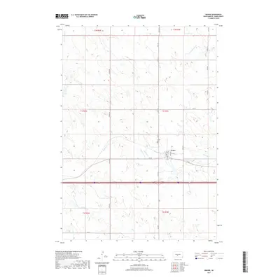
2017 Map of Draper
USGS Topo · Published 2017About this map
Draper sits at the heart of this Jones County landscape, where the town's grid of streets including Main St, 1st St, and Maple Ave meets the prairie. Located just north of the Interstate 90 corridor and SD 248, the community is defined by its relationship to the surrounding drainage networks. The meandering Medicine Creek flows eastward through the central portion of the map, joined by the N Fork Medicine Creek. To the west, Draper Cem is a notable landmark at the corner of Cemetery Rd. The topography is marked by several minor watercourses, including Bull Creek and Spring Creek in the south, illustrating the drainage patterns across the high plains of South Dakota. Large sections of land are organized into townships like t1s r30e, reflecting the enduring impact of the Public Land Survey System on the region's agricultural layout.
Find a feature on this map
30 named features on this map. Tap any name to fly to it.
Don’t see what you’re looking for? This feature index may not catch every label — zoom into the map to look around manually.
Map Details
Editions of this 2017 Draper Map
This is the sole edition of this map. No revisions or reprints were ever made.
Other maps of this area

1951 · Murdo SE
USGS Topo · 1:24,000

1951 · Murdo SW
USGS Topo · 1:24,000

1954 · Pierre
USGS Topo · 1:250,000

1955 · Martin
USGS Topo · 1:250,000

1958 · Pierre
USGS Topo · 1:250,000

1958 · Martin
USGS Topo · 1:250,000

1970 · Vivian SW
USGS Topo · 1:24,000

1972 · Pierre 3 SW
USGS Topo · 1:24,000

1972 · Draper
USGS Topo · 1:24,000

1972 · Murdo
USGS Topo · 1:24,000