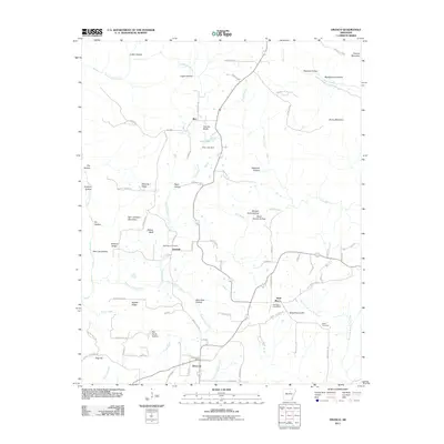
2011 Map of Drasco
USGS Topo · Published 2011About this map
Drasco Post Office and the surrounding rural community of Drasco anchor the southern portion of this landscape, where the terrain transitions from the heights of Fortune Mountain to the deep recesses of Lickin Hollow and Logan Hollow. The map records a network of established settlements including Ben, Fivemile, and Wolf Bayou, each connected by a winding system of county roads and named lanes like McCarty Ridge Rd. Local history is preserved in the location of the Macedonia Cemetery and White Cemetery, as well as landmarks like Schoolhouse Hill and the Wolf Bayou Post Office. Water shapes the geography here, from the impounded Stair Lake at the Stair Lake Dam to the drainage of Bothersome Creek, Possum Walk Creek, and McIntosh Branch Big Creek. This topographical study illustrates a region defined by its numerous hollows and ridges, such as Hawkins Ridge and McCarty Ridge, which have long dictated the placement of homesteads and transport routes.
Find a feature on this map
90 named features on this map. Tap any name to fly to it.
Don’t see what you’re looking for? This feature index may not catch every label — zoom into the map to look around manually.
Map Details
Editions of this 2011 Drasco Map
This is the sole edition of this map. No revisions or reprints were ever made.
Other maps of this area

1890 · Batesville
USGS Topo · 1:125,000

1891 · Batesville
USGS Topo · 1:125,000

1892 · Mountain View
USGS Topo · 1:125,000

1894 · Mountain View
USGS Topo · 1:125,000

1942 · Bethesda
USGS Topo · 1:24,000

1942 · Almond
USGS Topo · 1:31,680

1953 · Memphis
USGS Topo · 1:250,000

1956 · Memphis
USGS Topo · 1:250,000

1956 · Russellville
USGS Topo · 1:250,000

1964 · Russellville
USGS Topo · 1:250,000