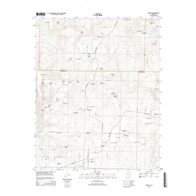
2014 Map of Drasco
USGS Topo · Published 2014About this map
The small settlements of Concord and Drasco anchor this portion of North Central Arkansas, where the landscape is defined by the winding course of Wolf Bayou and its many tributary hollows. Positioned along the border of Stone and Cleburne Counties, the terrain is characterized by prominent ridges such as McCarty Ridge and Hawkins Ridge, with dramatic vertical features like Victoria Bluffs and Richey Bluff rising above the valley floors. The drainage pattern is intricate, with Bothersome Cr and Fivemile Cr carving through the plateau.
Find a feature on this map
102 named features on this map. Tap any name to fly to it.
Don’t see what you’re looking for? This feature index may not catch every label — zoom into the map to look around manually.
Map Details
Editions of this 2014 Drasco Map
This is the sole edition of this map. No revisions or reprints were ever made.
Other maps of this area

1890 · Batesville
USGS Topo · 1:125,000

1891 · Batesville
USGS Topo · 1:125,000

1892 · Mountain View
USGS Topo · 1:125,000

1894 · Mountain View
USGS Topo · 1:125,000

1942 · Bethesda
USGS Topo · 1:24,000

1942 · Almond
USGS Topo · 1:31,680

1953 · Memphis
USGS Topo · 1:250,000

1956 · Memphis
USGS Topo · 1:250,000

1956 · Russellville
USGS Topo · 1:250,000

1964 · Russellville
USGS Topo · 1:250,000