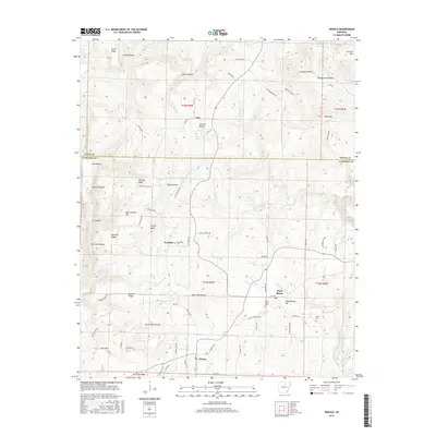
2017 Map of Drasco
USGS Topo · Published 2017About this map
Drasco and the surrounding Ozark foothills of Cleburne and Stone counties appear here in detail, defined by a landscape of steep ridges and named hollows. The settlement pattern follows the drainage of Fivemile Creek and Wolf Bayou, where small communities like Ben and the village of Wolf Bayou are situated among the higher ground of Hawkins Ridge and McCarty Ridge. Local history is anchored by several burial sites, including Macedonia Cem, Oak Grove Cem, and White Cem, providing important markers for genealogical research in this part of Arkansas. The terrain is notably rugged, with prominent landmarks such as Victoria Bluffs overlooking Stair Lake, and numerous family-named features like Sam Johnson Mtn and Ben Frank Hollow that reflect the region's long-standing land-use history.
Find a feature on this map
87 named features on this map. Tap any name to fly to it.
Don’t see what you’re looking for? This feature index may not catch every label — zoom into the map to look around manually.
Map Details
Editions of this 2017 Drasco Map
This is the sole edition of this map. No revisions or reprints were ever made.
Other maps of this area

1890 · Batesville
USGS Topo · 1:125,000

1891 · Batesville
USGS Topo · 1:125,000

1892 · Mountain View
USGS Topo · 1:125,000

1894 · Mountain View
USGS Topo · 1:125,000

1942 · Bethesda
USGS Topo · 1:24,000

1942 · Almond
USGS Topo · 1:31,680

1953 · Memphis
USGS Topo · 1:250,000

1956 · Memphis
USGS Topo · 1:250,000

1956 · Russellville
USGS Topo · 1:250,000

1964 · Russellville
USGS Topo · 1:250,000