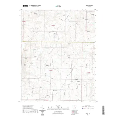
2020 Map of Drasco
USGS Topo · Published 2020About this map
Concord and Drasco anchor this interior Arkansas landscape, where the border between Stone County and Cleburne County cuts through a terrain defined by steep ridges and hollows. The rural settlement of Fivemile sits central to the map, while Ben occupies the northern reaches near Victoria Bluffs. The map reveals a deeply etched topography where water bodies like Wolf Bayou and Bothersome Cr have carved out named hollows that likely hosted family homesteads for generations. Notable markers of local heritage include the Macedonia Cem, Oak Grove Cem, and White Cem, which serve as vital points for genealogical research. The road network, including Mountain View RD and Heber Springs RD N, connects these isolated communities, winding around significant heights such as Sam Johnson Mtn and Tuttle Ridge. This detailed survey reflects the enduring rural character of the region, where the naming of every bluff and hollow signifies a close-knit connection to the land.
Find a feature on this map
95 named features on this map. Tap any name to fly to it.
Don’t see what you’re looking for? This feature index may not catch every label — zoom into the map to look around manually.
Map Details
Editions of this 2020 Drasco Map
This is the sole edition of this map. No revisions or reprints were ever made.
Other maps of this area

1890 · Batesville
USGS Topo · 1:125,000

1891 · Batesville
USGS Topo · 1:125,000

1892 · Mountain View
USGS Topo · 1:125,000

1894 · Mountain View
USGS Topo · 1:125,000

1942 · Bethesda
USGS Topo · 1:24,000

1942 · Almond
USGS Topo · 1:31,680

1953 · Memphis
USGS Topo · 1:250,000

1956 · Memphis
USGS Topo · 1:250,000

1956 · Russellville
USGS Topo · 1:250,000

1964 · Russellville
USGS Topo · 1:250,000