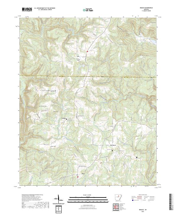
2024 Map of Drasco
USGS Topo · Published 2024About this map
Wolf Bayou and the small crossroads of Drasco anchor this interior Arkansas landscape, where the borders of Stone and Cleburne Counties meet across a series of ridges and hollows. The area is defined by a network of winding roads like Heber Springs Rd N and Mountain View Rd, which connect rural settlements such as Ben and Fivemile. The local geography is etched by watercourses including McIntosh Branch Big Creek and Possom Walk Creek, which have carved deep features like Shingle Knife Hollow and Blue Hole Hollow into the terrain.
Find a feature on this map
98 named features on this map. Tap any name to fly to it.
Don’t see what you’re looking for? This feature index may not catch every label — zoom into the map to look around manually.
Map Details
Editions of this 2024 Drasco Map
This is the sole edition of this map. No revisions or reprints were ever made.
Other maps of this area

1890 · Batesville
USGS Topo · 1:125,000

1891 · Batesville
USGS Topo · 1:125,000

1892 · Mountain View
USGS Topo · 1:125,000

1894 · Mountain View
USGS Topo · 1:125,000

1942 · Bethesda
USGS Topo · 1:24,000

1942 · Almond
USGS Topo · 1:31,680

1953 · Memphis
USGS Topo · 1:250,000

1956 · Memphis
USGS Topo · 1:250,000

1956 · Russellville
USGS Topo · 1:250,000

1964 · Russellville
USGS Topo · 1:250,000