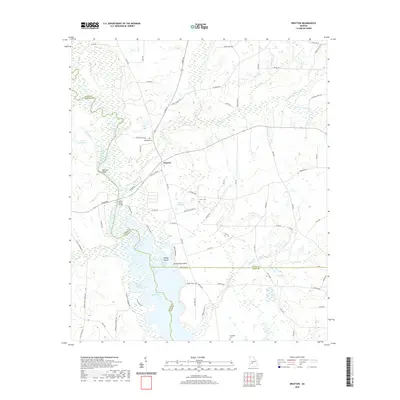
2020 Map of Drayton
USGS Topo · Published 2020About this map
Drayton serves as the focal point of this landscape where the borders of Dooly, Sumter, and Crisp Counties converge. The topography is defined by the complex water systems feeding into the northern reaches of Lake Blackshear, including the Gleaton-Johnson Slough and Turkey Creek. Near the riverbanks, distinctive landmarks such as Danville Bluff and Penny's Bluff rise above the wetlands, while Whisky Island and the evocatively named Glory Hole sit within the southern aquatic expanse. Local history is anchored by several rural burial grounds, including Macedonia Cem, Collier Cem, and Springhill Cem. Transportation patterns are marked by the Luther Storey Bridge crossing the Flint River, connecting the agricultural lands and scattered creek drainages like Pennahatchee Cr and Lime Creek. The map illustrates a typical South Georgia riverine environment where managed waterways and traditional rural settlements coexist.
Find a feature on this map
85 named features on this map. Tap any name to fly to it.
Don’t see what you’re looking for? This feature index may not catch every label — zoom into the map to look around manually.
Map Details
Editions of this 2020 Drayton Map
This is the sole edition of this map. No revisions or reprints were ever made.
Other maps of this area

1953 · Dothan
USGS Topo · 1:250,000

1953 · Waycross
USGS Topo · 1:250,000

1954 · Dothan
USGS Topo · 1:250,000

1955 · Dothan
USGS Topo · 1:250,000

1955 · Phenix City
USGS Topo · 1:250,000

1956 · Leslie
USGS Topo · 1:62,500

1957 · Phenix City
USGS Topo · 1:250,000

1957 · Macon
USGS Topo · 1:250,000

1958 · Macon
USGS Topo · 1:250,000

1958 · Phenix City
USGS Topo · 1:250,000