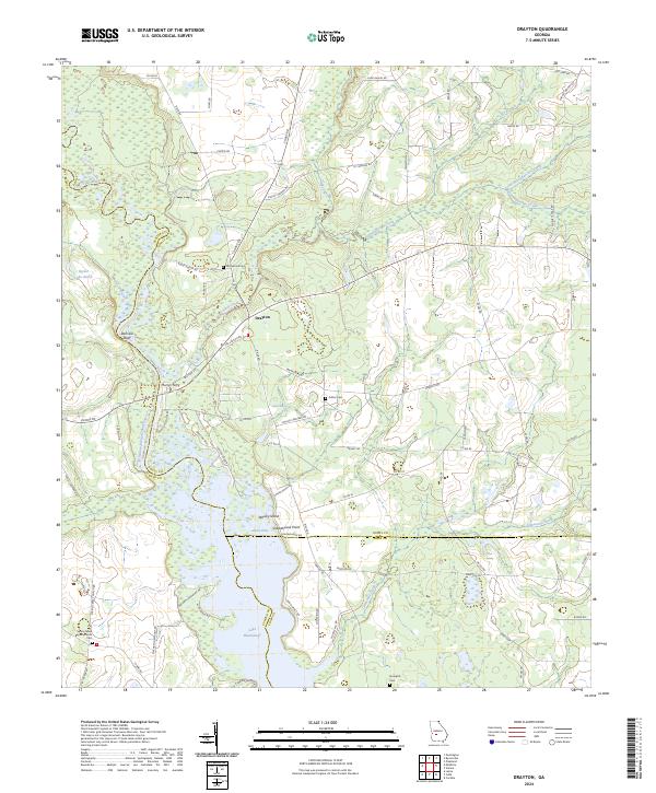
2024 Map of Drayton
USGS Topo · Published 2024About this map
The Flint River corridor and the northern reaches of Lake Blackshear dominate this Georgia landscape, marking the intersection of Dooly, Sumter, and Crisp counties. The settlement of Drayton sits just east of the river, serving as a focal point for a network of country roads like Mount Vernon Rd and Drayton Rd. This area retains much of its agrarian and riparian character, with the river's winding path giving way to significant features like Danville Bluff and the curiously named Glory Hole in the wetlands to the south.
Find a feature on this map
86 named features on this map. Tap any name to fly to it.
Don’t see what you’re looking for? This feature index may not catch every label — zoom into the map to look around manually.
Map Details
Editions of this 2024 Drayton Map
This is the sole edition of this map. No revisions or reprints were ever made.
Other maps of this area

1953 · Dothan
USGS Topo · 1:250,000

1953 · Waycross
USGS Topo · 1:250,000

1954 · Dothan
USGS Topo · 1:250,000

1955 · Dothan
USGS Topo · 1:250,000

1955 · Phenix City
USGS Topo · 1:250,000

1956 · Leslie
USGS Topo · 1:62,500

1957 · Phenix City
USGS Topo · 1:250,000

1957 · Macon
USGS Topo · 1:250,000

1958 · Macon
USGS Topo · 1:250,000

1958 · Phenix City
USGS Topo · 1:250,000