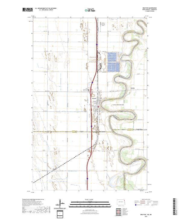
2024 Map of Drayton
USGS Topo · Published 2024About this map
The Red River of the North winds in sharp, serpentine loops along the border between North Dakota and Minnesota, anchoring this modern topographical survey. The city of Drayton occupies a prominent bend in the river, serving as a regional hub where N Main St and S Main St meet local transportation corridors. The surrounding landscape is characterized by the high-precision grid of the Public Land Survey System, which organizes the fertile agricultural plains of Pembina County and the neighboring Marshall and Kittson counties in Minnesota.
Find a feature on this map
36 named features on this map. Tap any name to fly to it.
Don’t see what you’re looking for? This feature index may not catch every label — zoom into the map to look around manually.
Map Details
Editions of this 2024 Drayton Map
This is the sole edition of this map. No revisions or reprints were ever made.
Other maps of this area

1918 · Acton
USGS Topo · 1:62,500

1939 · Drayton
USGS Topo · 1:62,500

1939 · Glasston
USGS Topo · 1:62,500

1941 · Drayton
USGS Topo · 1:62,500

1941 · Glasston
USGS Topo · 1:62,500

1943 · Grafton
USGS Topo · 1:62,500

1952 · Thief River Falls
USGS Topo · 1:250,000

1956 · Thief River Falls
USGS Topo · 1:250,000

1957 · Thief River Falls
USGS Topo · 1:250,000
1960 · Big Woods NW
USGS Topo · 1:24,000