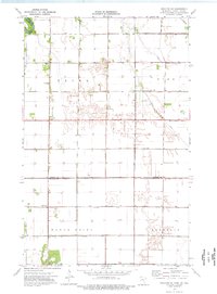
1974 Map of Drayton SE
USGS Topo · Published 1976About this map
The Red River of the North forms the western boundary of this landscape along the Minnesota and North Dakota border, where the flat terrain of the Red River Valley is dominated by a complex network of man-made drainage systems. Numerous engineering projects such as Judicial Ditch No 10, Judicial Ditch No 19, and County Ditch No 7 underscore the area's transition into a highly managed agricultural environment during the mid-1970s.
Find a feature on this map
24 named features on this map. Tap any name to fly to it.
Don’t see what you’re looking for? This feature index may not catch every label — zoom into the map to look around manually.
Map Details
Editions of this 1974 Drayton SE Map
This is the sole edition of this map. No revisions or reprints were ever made.
Other maps of this area

1918 · Acton
USGS Topo · 1:62,500

1918 · Argyle
USGS Topo · 1:62,500

1939 · Drayton
USGS Topo · 1:62,500

1939 · Kennedy
USGS Topo · 1:62,500

1941 · Kennedy
USGS Topo · 1:62,500

1941 · Drayton
USGS Topo · 1:62,500

1952 · Thief River Falls
USGS Topo · 1:250,000

1954 · Stephen
USGS Topo · 1:62,500

1956 · Thief River Falls
USGS Topo · 1:250,000

1957 · Thief River Falls
USGS Topo · 1:250,000