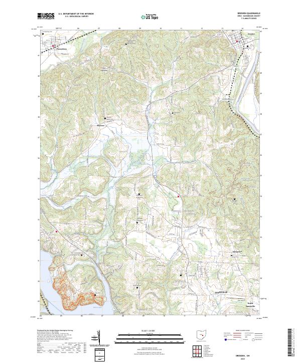
2023 Map of Dresden
USGS Topo · Published 2023About this map
Dresden and Frazeysburg anchor this survey of the Muskingum County landscape, where the Muskingum River flows past the northeastern corner and Dillon Lake occupies the southwestern corner. The terrain is defined by several creek systems including Wakatamika Creek, Big Run, and Bartlett Run, which influenced the placement of early settlements and family burial grounds. Local history is deeply embedded in the land through numerous religious and family landmarks, such as the Muskingum Presbyterian Cem and Sherrods Chapel Cem.
Find a feature on this map
144 named features on this map. Tap any name to fly to it.
Don’t see what you’re looking for? This feature index may not catch every label — zoom into the map to look around manually.
Map Details
Editions of this 2023 Dresden Map
This is the sole edition of this map. No revisions or reprints were ever made.
Other maps of this area

1908 · Conesville
USGS Topo · 1:62,500

1910 · Frazeysburg
USGS Topo · 1:62,500

1910 · Philo
USGS Topo · 1:62,500

1910 · Zanesville
USGS Topo · 1:62,500

1910 · Conesville
USGS Topo · 1:62,500

1947 · Columbus
USGS Topo · 1:250,000

1949 · Clarksburg
USGS Topo · 1:250,000

1950 · Marion
USGS Topo · 1:250,000

1951 · Canton
USGS Topo · 1:250,000

1953 · Canton
USGS Topo · 1:250,000