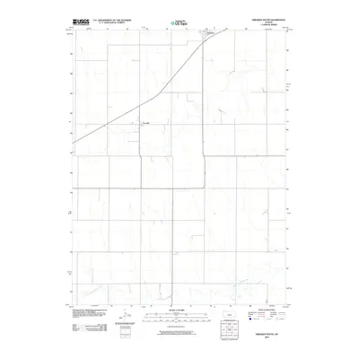
2009 Map of Dresden South
USGS Topo · Published 2009About this map
Dresden and the small settlement of Leoville anchor this agricultural landscape in northwestern Kansas. The terrain is defined by the headwaters of the North Fork Solomon River, which meanders across the southern portion of the quadrangle. The map illustrates a classic Great Plains section-line road grid, revealing how late 20th and early 21st-century land management shaped Decatur County. While the township of Dresden occupies the northern edge along the highway corridor, the rest of the sheet is primarily characterized by the drainage patterns of the Solomon River basin, providing a clear record of the rural infrastructure and land use in this part of the High Plains during the first decade of the 2000s.
Find a feature on this map
3 named features on this map. Tap any name to fly to it.
Don’t see what you’re looking for? This feature index may not catch every label — zoom into the map to look around manually.
Map Details
Editions of this 2009 Dresden South Map
This is the sole edition of this map. No revisions or reprints were ever made.
Other maps of this area

1951 · Selden
USGS Topo · 1:62,500

1954 · Goodland
USGS Topo · 1:250,000

1956 · Goodland
USGS Topo · 1:250,000

1957 · Goodland
USGS Topo · 1:250,000
1965 · Selden NE
USGS Topo · 1:24,000
1978 · Dresden North
USGS Topo · 1:24,000
1978 · Jennings
USGS Topo · 1:24,000

1978 · Allison
USGS Topo · 1:24,000

1978 · Selden
USGS Topo · 1:24,000

1978 · Dresden South
USGS Topo · 1:24,000