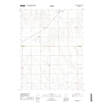
2018 Map of Dresden South
USGS Topo · Published 2018About this map
Dresden and Leoville anchor this portion of the High Plains, situated at the boundary between Decatur and Sheridan counties. The landscape is defined by the winding course of the N Fork Solomon River in the southern sections, where the terrain transitions into a series of drainages and draws feeding the river valley. The settlement at Dresden is mapped with a distinct grid including Railroad St and Kings Ave, reflecting its historic orientation toward rail transportation and regional trade.
Find a feature on this map
24 named features on this map. Tap any name to fly to it.
Don’t see what you’re looking for? This feature index may not catch every label — zoom into the map to look around manually.
Map Details
Editions of this 2018 Dresden South Map
This is the sole edition of this map. No revisions or reprints were ever made.
Other maps of this area

1951 · Selden
USGS Topo · 1:62,500

1954 · Goodland
USGS Topo · 1:250,000

1956 · Goodland
USGS Topo · 1:250,000

1957 · Goodland
USGS Topo · 1:250,000
1965 · Selden NE
USGS Topo · 1:24,000
1978 · Dresden North
USGS Topo · 1:24,000
1978 · Jennings
USGS Topo · 1:24,000

1978 · Allison
USGS Topo · 1:24,000

1978 · Selden
USGS Topo · 1:24,000

1978 · Dresden South
USGS Topo · 1:24,000