2023 Map of Dresden
USGS Topo · Published 2023About this map
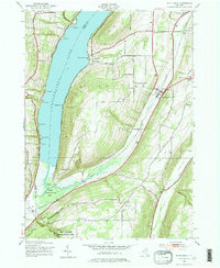
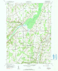
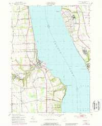
Seneca Lake serves as the central divide in this modern landscape, where the waters of Keuka Lake Outlet meet the shore at Dresden. This area is characterized by its transition from the agricultural uplands of Yates County to the prominent shoreline points of Seneca County, including Pontius Point and Long Point. For those tracing local history, several burial grounds are scattered throughout the region, such as Evergreen Cem and City Hill Cem, alongside the industrial history suggested by Mays Mills. The eastern shore is dominated by the sprawling footprint of the Seneca Army Depot and the recreational expanse of Sampson State Park, reflecting the region's varied mid-century military and modern parkland use. The presence of the Seneca River and ancient drainage patterns like Indian Creek continue to define the hydrology of this Finger Lakes territory.
Find a feature on this map
71 named features on this map. Tap any name to fly to it.
Don’t see what you’re looking for? This feature index may not catch every label — zoom into the map to look around manually.
Map Details
Editions of this 2023 Dresden Map
This is the sole edition of this map. No revisions or reprints were ever made.
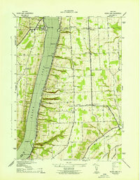
Historical Maps of Kendaia Through Time
7 maps found