
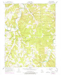
1954 Map of Drew
USGS Topo · Published 1959About this map
The Gasconade River and the Osage Fork wind through this mid-century landscape in Laclede County, marking a terrain defined by deep hollows and creek drainage. Within the Mark Twain National Forest, small rural communities such as Drew and Jacksonville are documented alongside specialized local commerce at Meeks Store. The map illustrates a high density of mid-20th-century rural infrastructure, particularly a series of one-room schools like Heard School, Franklin School, and Harmony School that served these isolated river-valley settlements. For genealogical researchers, the inclusion of family-named landmarks such as Heard Cemetery, Hamilton Cemetery, and Bohannon Cemetery provides precise locations for ancestral homesteads. Notable natural features like Blue Spring, Maybell Spring, and the distinctive Panther Cave highlight the karst topography characteristic of the Missouri Ozarks during this era of field survey.
Find a feature on this map
37 named features on this map. Tap any name to fly to it.
Don’t see what you’re looking for? This feature index may not catch every label — zoom into the map to look around manually.
Map Details
Editions of this 1954 Drew Map
2 editions found
Other maps of this area

1931 · Manes
USGS Topo · 1:48,000

1941 · Manes
USGS Topo · 1:62,500

1941 · Lebanon
USGS Topo · 1:62,500

1943 · Lebanon
USGS Topo · 1:62,500

1943 · Manes
USGS Topo · 1:62,500

1943 · Drynob
USGS Topo · 1:62,500

1954 · Springfield
USGS Topo · 1:250,000

1954 · Drynob
USGS Topo · 1:62,500
1954 · Winnipeg
USGS Topo · 1:24,000
1954 · Brownfield
USGS Topo · 1:24,000