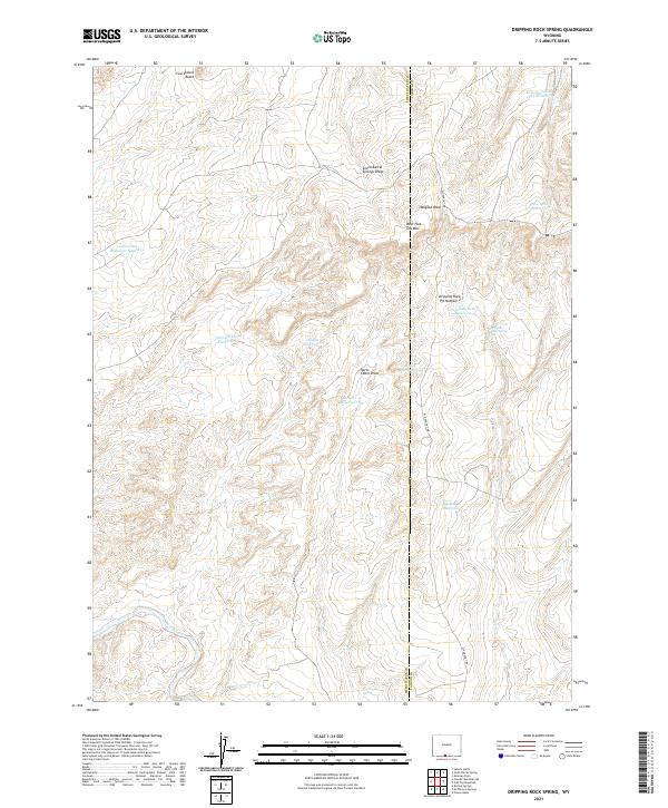
2021 Map of Dripping Rock Spring
USGS Topo · Published 2021About this map
Dripping Rock Spring and Hartt Cabin Spring anchor a high-desert landscape defined by scarce water resources along the boundary of Sweetwater and Carbon counties. This 2021 survey reveals a complex network of artificial catchments and stock ponds, including Horse Trap Reservoir, Alkali Reservoir, and Snow Bank Reservoir, which are vital for land management in this arid environment. The presence of Dripping Rock Pit Number 2 and the isolated W Hangout Rd suggests a landscape dedicated to resource extraction and grazing. High points such as Courthouse Butte and West Flat Top Mtn provide visual landmarks across the high plains, while topographic features like South Barrel Springs Draw and Hartt Cabin Draw dictate the flow of seasonal drainage toward Sand Cr.
Find a feature on this map
26 named features on this map. Tap any name to fly to it.
Don’t see what you’re looking for? This feature index may not catch every label — zoom into the map to look around manually.
Map Details
Editions of this 2021 Dripping Rock Spring Map
This is the sole edition of this map. No revisions or reprints were ever made.
Other maps of this area

1954 · Rawlins
USGS Topo · 1:250,000

1954 · Rock Springs
USGS Topo · 1:250,000

1958 · Rawlins
USGS Topo · 1:250,000

1958 · Rock Springs
USGS Topo · 1:250,000

1962 · Rawlins
USGS Topo · 1:250,000

1962 · Rock Springs
USGS Topo · 1:250,000

1967 · Rawlins
USGS Topo · 1:250,000

1970 · South Barrel Spring
USGS Topo · 1:24,000

1970 · Mexican Flats
USGS Topo · 1:24,000
1970 · Powder Mountain NE
USGS Topo · 1:24,000