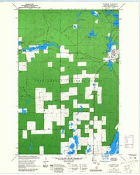
1971 Map of Drummond
USGS Topo · Published 1985About this map
Drummond serves as the primary settlement in this northern Wisconsin woodland, situated alongside the Mill Pond Lake. The surrounding landscape is dominated by the Chequamegon National Forest, where a dense network of water bodies like Pigeon Lake and Owen Lake define the geography. One of the most striking historical elements is the presence of an Old RR Grade and an Old Railroad Grade, which trace the path of former logging or industrial rail lines through the timber. These grades, along with named forest routes such as Bearsdale Road and Holly Lake Road, reflect the region's history as a managed forest and timber resource. Educational and research footprints are also evident at the U W Field Station near the shore of Pigeon Lake.
Find a feature on this map
44 named features on this map. Tap any name to fly to it.
Don’t see what you’re looking for? This feature index may not catch every label — zoom into the map to look around manually.
Map Details
Editions of this 1971 Drummond Map
3 editions found
Other maps of this area

1943 · Namekagon Lake
USGS Topo · 1:48,000

1944 · Drummond
USGS Topo · 1:48,000

1944 · Grandview
USGS Topo · 1:48,000

1944 · Hayward
USGS Topo · 1:48,000

1945 · Namekagon Lake
USGS Topo · 1:48,000

1947 · Drummond
USGS Topo · 1:48,000

1947 · Grandview
USGS Topo · 1:48,000

1953 · Ashland
USGS Topo · 1:250,000

1958 · Ashland
USGS Topo · 1:250,000
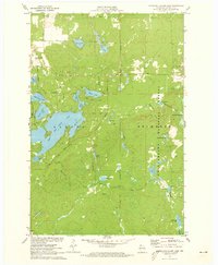
1971 · Upper Eau Claire Lake
USGS Topo · 1:24,000