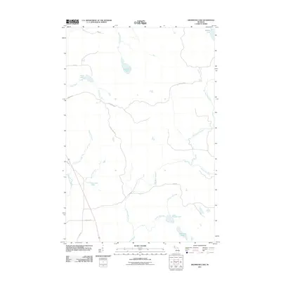
2011 Map of Drummond Lake
USGS Topo · Published 2011About this map
Drummond Lake and its surrounding wetlands define this portion of the Michigan Upper Peninsula, where a complex network of waterways feeds into the primary drainage of the East Branch Net River. The terrain is characterized by numerous small lakes and glacial kettle ponds, including Mogans Lake in the northeast and Fox Farm Lake further south. These water bodies are connected by a series of creeks such as Tracy Creek and County Line Creek, illustrating the natural hydrologic flow of the region before significant industrial alteration.
Find a feature on this map
20 named features on this map. Tap any name to fly to it.
Don’t see what you’re looking for? This feature index may not catch every label — zoom into the map to look around manually.
Map Details
Editions of this 2011 Drummond Lake Map
This is the sole edition of this map. No revisions or reprints were ever made.
Other maps of this area

1895 · Ned Lake
USGS Topo · 1:62,500

1895 · Perch Lake
USGS Topo · 1:62,500

1954 · Perch Lake
USGS Topo · 1:62,500

1954 · Sidnaw
USGS Topo · 1:62,500

1955 · Ned Lake
USGS Topo · 1:62,500

1955 · Herman
USGS Topo · 1:62,500

1958 · Iron River
USGS Topo · 1:250,000

1960 · Iron River
USGS Topo · 1:250,000

1961 · Iron River
USGS Topo · 1:250,000

1967 · Iron River
USGS Topo · 1:250,000