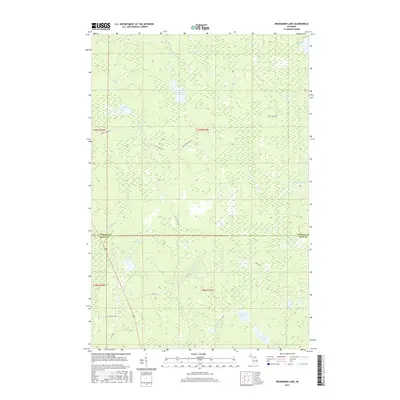
2017 Map of Drummond Lake
USGS Topo · Published 2017About this map
Drummond Lake lies at the center of this Upper Peninsula landscape, marking a terrain defined by complex hydrography along the Baraga Co Iron Co line. The map captures a transition between the northern Murphy River drainage and the southern waters of the E Br Net River. This area is characterized by numerous small lakes and creeks, including Tracy Lake, Little Pickerel Lake, and Hemlock Lake, which are interconnected by a network of seasonal streams and forest roads. The presence of Fox Farm Lake and Fox Farm Cr suggests early 20th-century agricultural or specialized farming attempts in this heavily forested region. Modern access is primarily facilitated by Drummond Lake Rd and Tracy Lake Rd, which weave through the townships of t47n r33w and t46n r33w, providing a detailed look at the rural infrastructure in this part of Michigan.
Find a feature on this map
26 named features on this map. Tap any name to fly to it.
Don’t see what you’re looking for? This feature index may not catch every label — zoom into the map to look around manually.
Map Details
Editions of this 2017 Drummond Lake Map
This is the sole edition of this map. No revisions or reprints were ever made.
Other maps of this area

1895 · Ned Lake
USGS Topo · 1:62,500

1895 · Perch Lake
USGS Topo · 1:62,500

1954 · Perch Lake
USGS Topo · 1:62,500

1954 · Sidnaw
USGS Topo · 1:62,500

1955 · Ned Lake
USGS Topo · 1:62,500

1955 · Herman
USGS Topo · 1:62,500

1958 · Iron River
USGS Topo · 1:250,000

1960 · Iron River
USGS Topo · 1:250,000

1961 · Iron River
USGS Topo · 1:250,000

1967 · Iron River
USGS Topo · 1:250,000