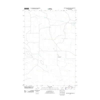
2011 Map of Dry Blood Creek West
USGS Topo · Published 2011About this map
Dry Blood Creek and its tributaries carve a complex drainage pattern across this Petroleum County landscape, illustrating the ephemeral water systems of central Montana. The presence of the Resettlement FSA Number 5 Dam serves as a tangible link to New Deal-era land management programs, where the Farm Security Administration worked to stabilize the local agricultural economy through water conservation and rangeland improvements. This sparse network of waterways, including the South Fork Dry Blood Creek and the meandering Box Elder Creek, is navigated by a handful of established routes like Welter Divide Rd. To the south, Fords Creek cuts through the terrain, completing a picture of a region defined by its hydrography and the infrastructure designed to capture every drop of seasonal moisture in an arid environment.
Find a feature on this map
6 named features on this map. Tap any name to fly to it.
Don’t see what you’re looking for? This feature index may not catch every label — zoom into the map to look around manually.
Map Details
Editions of this 2011 Dry Blood Creek West Map
This is the sole edition of this map. No revisions or reprints were ever made.
Other maps of this area

1954 · Lewistown
USGS Topo · 1:250,000

1959 · Lewistown
USGS Topo · 1:250,000

1985 · Brown Spring
USGS Topo · 1:24,000

1985 · Bear Creek Reservoir SE
USGS Topo · 1:24,000

1985 · Valentine
USGS Topo · 1:24,000

1986 · Wild Horse Lake
USGS Topo · 1:24,000

1986 · Dry Blood Creek West
USGS Topo · 1:24,000

1986 · Winnett North
USGS Topo · 1:24,000

1986 · Dry Blood Creek East
USGS Topo · 1:24,000

1986 · Teigen
USGS Topo · 1:24,000