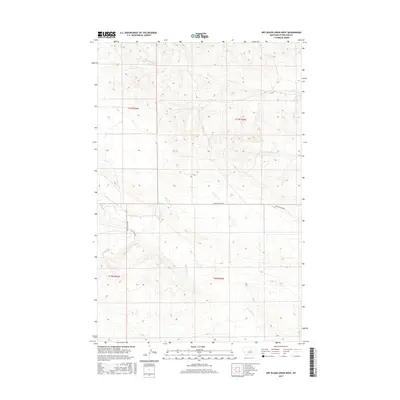
2017 Map of Dry Blood Creek West
USGS Topo · Published 2017About this map
Dry Blood Creek and its intermittent tributaries carve through the heart of Petroleum County, revealing a landscape defined by seasonal watercourses and the Welter Divide Road corridor. This modern survey illustrates the expansive grazing lands and complex topography typical of the central Montana plains during the early 21st century. The network of drainages, including the South Fork Dry Blood Creek and Box Elder Creek, highlights how water erosion has shaped the local elevation patterns. Navigational infrastructure is limited to rural routes like Nunn Road, which traverses the sectional boundaries established by the Public Land Survey System, specifically marking townships t17n r25e and t17n r26e. For those researching local land use or geographic shifts in this region, the map provides a precise record of the drainage basins and the few maintained roads that provide access to this isolated section of the state.
Find a feature on this map
10 named features on this map. Tap any name to fly to it.
Don’t see what you’re looking for? This feature index may not catch every label — zoom into the map to look around manually.
Map Details
Editions of this 2017 Dry Blood Creek West Map
This is the sole edition of this map. No revisions or reprints were ever made.
Other maps of this area

1954 · Lewistown
USGS Topo · 1:250,000

1959 · Lewistown
USGS Topo · 1:250,000

1985 · Brown Spring
USGS Topo · 1:24,000

1985 · Bear Creek Reservoir SE
USGS Topo · 1:24,000

1985 · Valentine
USGS Topo · 1:24,000

1986 · Wild Horse Lake
USGS Topo · 1:24,000

1986 · Dry Blood Creek West
USGS Topo · 1:24,000

1986 · Winnett North
USGS Topo · 1:24,000

1986 · Dry Blood Creek East
USGS Topo · 1:24,000

1986 · Teigen
USGS Topo · 1:24,000