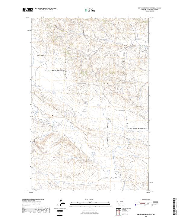
2024 Map of Dry Blood Creek West
USGS Topo · Published 2024About this map
Dry Blood Creek defines the northern reaches of this Petroleum County landscape, where the terrain transitions across the Welter Divide Rd. This area is characterized by the intricate drainage systems of Box Elder Creek and Fords Creek, which carve through the high plains of central Montana. The map provides a clear look at the rural infrastructure of the early 21st century, dominated by a grid of township lines including t17n r26e and t16n r25e. Though sparse in settlements, the inclusion of specific water sources like a lone Spring and local thoroughfares such as Nunn Rd highlights the vital importance of water and access in this ranching country. For researchers, these features offer a precise record of land division and natural landmarks in one of the state's most lightly populated counties.
Find a feature on this map
12 named features on this map. Tap any name to fly to it.
Don’t see what you’re looking for? This feature index may not catch every label — zoom into the map to look around manually.
Map Details
Editions of this 2024 Dry Blood Creek West Map
This is the sole edition of this map. No revisions or reprints were ever made.
Other maps of this area

1954 · Lewistown
USGS Topo · 1:250,000

1959 · Lewistown
USGS Topo · 1:250,000

1985 · Brown Spring
USGS Topo · 1:24,000

1985 · Bear Creek Reservoir SE
USGS Topo · 1:24,000

1985 · Valentine
USGS Topo · 1:24,000

1986 · Wild Horse Lake
USGS Topo · 1:24,000

1986 · Dry Blood Creek West
USGS Topo · 1:24,000

1986 · Winnett North
USGS Topo · 1:24,000

1986 · Dry Blood Creek East
USGS Topo · 1:24,000

1986 · Teigen
USGS Topo · 1:24,000