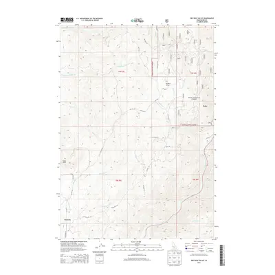
2013 Map of Dry Buck Valley
USGS Topo · Published 2013About this map
Dry Buck Valley and the surrounding peaks of Dry Buck Mtn and Timber Butte dominate this Boise County landscape. The area is defined by the drainage networks of Soldier Cr and Brownlee Cr, which flow through the steep topography of the Boise National Forest. The settlement of Banks sits along the eastern edge where the terrain meets the Payette River, serving as a critical junction for local transit via Church Ln and Banks Grade. To the west, the small community of Brownlee is situated near the intersection of Brownlee Rd and Cutoff Rd. This 2013 survey illustrates the complex web of Forest Service roads, including Nfdr 643 and Dry Buck Rd, which provide access to the high ridges and the winding courses of the north and middle forks of the local creek systems.
Find a feature on this map
50 named features on this map. Tap any name to fly to it.
Don’t see what you’re looking for? This feature index may not catch every label — zoom into the map to look around manually.
Map Details
Editions of this 2013 Dry Buck Valley Map
This is the sole edition of this map. No revisions or reprints were ever made.
Other maps of this area

1892 · Boise
USGS Topo · 1:125,000

1894 · Squaw Creek
USGS Topo · 1:125,000

1897 · Boise
USGS Topo · 1:125,000

1953 · Banks
USGS Topo · 1:62,500

1953 · Montour
USGS Topo · 1:62,500

1955 · Baker
USGS Topo · 1:250,000

1955 · Boise
USGS Topo · 1:250,000

1957 · Horseshoe Bend
USGS Topo · 1:24,000
1957 · Harris Creek Summit
USGS Topo · 1:24,000

1958 · Boise
USGS Topo · 1:250,000