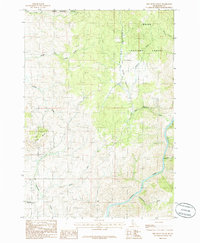
1985 Map of Dry Buck Valley
USGS Topo · Published 1986About this map
Dry Buck Valley dominates this mid-1980s terrain, located within the expansive Boise National Forest. The landscape is defined by the sharp descent from high timbered ridges toward the Payette River in the southeast corner. A complex network of drainage basins, including the various forks of Soldier Creek and Dry Buck Creek, illustrates the watershed's rugged character and the importance of these water sources to the regional geography.
Find a feature on this map
14 named features on this map. Tap any name to fly to it.
Don’t see what you’re looking for? This feature index may not catch every label — zoom into the map to look around manually.
Map Details
Editions of this 1985 Dry Buck Valley Map
This is the sole edition of this map. No revisions or reprints were ever made.
Other maps of this area

1892 · Boise
USGS Topo · 1:125,000

1894 · Squaw Creek
USGS Topo · 1:125,000

1897 · Boise
USGS Topo · 1:125,000

1953 · Banks
USGS Topo · 1:62,500

1953 · Montour
USGS Topo · 1:62,500

1955 · Baker
USGS Topo · 1:250,000

1955 · Boise
USGS Topo · 1:250,000

1957 · Horseshoe Bend
USGS Topo · 1:24,000
1957 · Harris Creek Summit
USGS Topo · 1:24,000

1958 · Boise
USGS Topo · 1:250,000