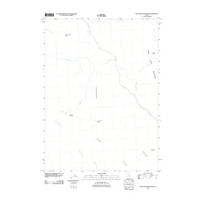
2011 Map of Dry Canyon Mountain
USGS Topo · Published 2011About this map
Tyrell Cabin Burials sits isolated in the southeastern reaches of this high-elevation terrain, a rare genealogical marker in a landscape defined by its complex drainage network and high ridges. The eastern edge of the quadrangle is dominated by the Goose Creek Mountains, where Devils Gate and Kimber Canyon dictate the flow of water and travel. Navigation through this territory relies on Goose Creek Rd, which traces the path of Goose Creek and its various tributaries like Joe Dahar Creek. To the west, the landscape rises into prominent peaks including Beatty Mountain and Meadow Creek Butte. Between these heights lies the Dry Canyon Basin, a significant catchment area feeding into the winding Dry Canyon. The distribution of Beatty Springs and numerous creeks such as Hardesty Creek and Straight Fork Creek underscores the importance of water sources in this high-desert environment.
Find a feature on this map
16 named features on this map. Tap any name to fly to it.
Don’t see what you’re looking for? This feature index may not catch every label — zoom into the map to look around manually.
Map Details
Editions of this 2011 Dry Canyon Mountain Map
This is the sole edition of this map. No revisions or reprints were ever made.
Other maps of this area

1954 · Brigham City
USGS Topo · 1:250,000

1955 · Wells
USGS Topo · 1:250,000

1958 · Wells
USGS Topo · 1:250,000

1958 · Brigham City
USGS Topo · 1:250,000

1959 · Cotton Thomas Basin
USGS Topo · 1:62,500

1961 · Wells
USGS Topo · 1:250,000

1961 · Goose Creek
USGS Topo · 1:62,500

1961 · Dairy Valley
USGS Topo · 1:62,500

1962 · Brigham City
USGS Topo · 1:250,000
1971 · Grouse Creek
USGS Topo · 1:24,000