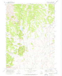
1971 Map of Grouse Creek
USGS Topo · Published 1974About this map
Grouse Creek Valley dominates this high-altitude landscape in Box Elder County, where isolated water sources like Buckskin Spring and Etna Spring define the pattern of rural survival. The settlement of Grouse Creek sits at the northern end of the valley, supported by a network of seasonal drainages including Straight Fork Creek and Buckskin Wash. The presence of several wells and a Flowing Well throughout the basin highlights the critical importance of groundwater for ranching operations in this arid region.
Find a feature on this map
31 named features on this map. Tap any name to fly to it.
Don’t see what you’re looking for? This feature index may not catch every label — zoom into the map to look around manually.
Map Details
Editions of this 1971 Grouse Creek Map
2 editions found
Other maps of this area

1954 · Brigham City
USGS Topo · 1:250,000

1955 · Wells
USGS Topo · 1:250,000

1958 · Wells
USGS Topo · 1:250,000

1958 · Brigham City
USGS Topo · 1:250,000

1959 · Cotton Thomas Basin
USGS Topo · 1:62,500

1961 · Wells
USGS Topo · 1:250,000

1961 · Goose Creek
USGS Topo · 1:62,500

1961 · Dairy Valley
USGS Topo · 1:62,500

1962 · Brigham City
USGS Topo · 1:250,000
1971 · Toms Cabin Spring
USGS Topo · 1:24,000