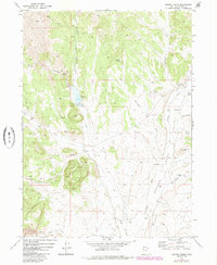
1971 Map of Grouse Creek
USGS Topo · Published 1984About this map
Grouse Creek serves as the focal point for this high-desert landscape in northern Utah, where the life of the valley is dictated by the water flowing from the surrounding peaks. The map reveals a systematic approach to water management in an arid environment, notably through the Etna Reservoir and the network of natural springs like Etna Spring and Buckskin Spring. Settlement is sparse and largely confined to the Grouse Valley, where the economy appears tied to land use and ranching rather than heavy industry.
Find a feature on this map
28 named features on this map. Tap any name to fly to it.
Don’t see what you’re looking for? This feature index may not catch every label — zoom into the map to look around manually.
Map Details
Editions of this 1971 Grouse Creek Map
2 editions found
Other maps of this area

1954 · Brigham City
USGS Topo · 1:250,000

1955 · Wells
USGS Topo · 1:250,000

1958 · Wells
USGS Topo · 1:250,000

1958 · Brigham City
USGS Topo · 1:250,000

1959 · Cotton Thomas Basin
USGS Topo · 1:62,500

1961 · Wells
USGS Topo · 1:250,000

1961 · Goose Creek
USGS Topo · 1:62,500

1961 · Dairy Valley
USGS Topo · 1:62,500

1962 · Brigham City
USGS Topo · 1:250,000
1971 · Toms Cabin Spring
USGS Topo · 1:24,000