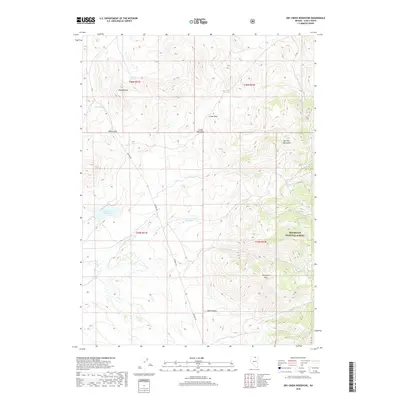
2018 Map of Dry Creek Reservoir
USGS Topo · Published 2018About this map
Paisewa Goei sits amidst the high desert terrain of northern Elko County, where the southern reaches of the Bull Run Mountains descend into the basin. The landscape is defined by its water management and grazing infrastructure, anchored by the Dry Creek Reservoir and numerous vital water sources such as Granger Spring and Barrel Spring. These features suggest a region shaped by livestock ranching and the challenges of high-altitude water storage.
Find a feature on this map
23 named features on this map. Tap any name to fly to it.
Don’t see what you’re looking for? This feature index may not catch every label — zoom into the map to look around manually.
Map Details
Editions of this 2018 Dry Creek Reservoir Map
This is the sole edition of this map. No revisions or reprints were ever made.
Other maps of this area

1939 · Owyhee
USGS Topo · 1:62,500

1942 · Owyhee
USGS Topo · 1:62,500

1955 · McDermitt
USGS Topo · 1:250,000

1956 · Bull Run
USGS Topo · 1:62,500

1959 · McDermitt
USGS Topo · 1:250,000

1964 · Hat Peak
USGS Topo · 1:62,500

1964 · Wilson Reservoir
USGS Topo · 1:62,500
1970 · Ungina Wongo
USGS Topo · 1:24,000
1971 · Owyhee
USGS Topo · 1:24,000
1971 · The Point
USGS Topo · 1:24,000