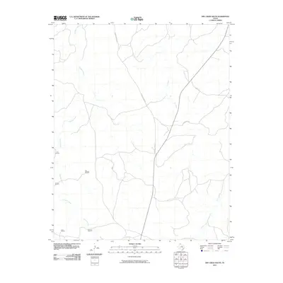
2010 Map of Dry Creek South
USGS Topo · Published 2010About this map
Tallahone Creek and its winding tributaries dominate this landscape in the Texas Panhandle, illustrating a region where water management is central to ranching operations. The terrain is marked by a network of named landmarks essential for livestock and local navigation, including the Tree Windmill and Five Tub Windmill. These features, along with Sandy Windmill and the Lake Theis Windmill, signify the critical role of groundwater infrastructure in this arid environment. Roads like Reynolds Ranch Rd and Ledrick Ranch Rd provide the primary access through the drainage basins of Dry Creek and Chicken Creek, tracing the paths between established ranching properties. This document records the distribution of these vital water points and rural routes, reflecting the persistent ranching culture of Roberts County.
Find a feature on this map
11 named features on this map. Tap any name to fly to it.
Don’t see what you’re looking for? This feature index may not catch every label — zoom into the map to look around manually.
Map Details
Editions of this 2010 Dry Creek South Map
This is the sole edition of this map. No revisions or reprints were ever made.
Other maps of this area

1954 · Amarillo
USGS Topo · 1:250,000

1958 · Amarillo
USGS Topo · 1:250,000

1971 · Dry Creek South
USGS Topo · 1:24,000

1971 · Dry Creek SE
USGS Topo · 1:24,000

1971 · Skellytown NE
USGS Topo · 1:24,000

1971 · Dry Creek NE
USGS Topo · 1:24,000

1971 · Dry Creek North
USGS Topo · 1:24,000

1971 · Pampa NW
USGS Topo · 1:24,000

1971 · Garden Springs
USGS Topo · 1:24,000

1971 · Adobe Creek SE
USGS Topo · 1:24,000