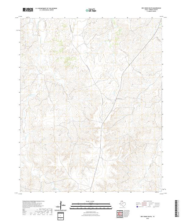
2022 Map of Dry Creek South
USGS Topo · Published 2022About this map
Tallahone Cr and Dry Cr carve intricate drainage patterns across this portion of Roberts County, defining a landscape shaped by intermittent waterflow in the Texas Panhandle. This recent survey shows a region where modern infrastructure is minimal, centered largely on a sparse network of ranch roads that navigate the complex topography. These thoroughfares, including Reynolds Ranch Rd and Antelope Hills Rd, reflect the enduring importance of large-scale landholdings in this part of the state. The convergence of Chicken Cr in the southeastern quadrant underscores the watershed's orientation toward the Canadian River basin. For those studying modern land use or contemporary ranching boundaries, the alignment of Catfish Rd and Ledrick Hoor Rd provides essential geographic context for this sparsely populated territory.
Find a feature on this map
7 named features on this map. Tap any name to fly to it.
Don’t see what you’re looking for? This feature index may not catch every label — zoom into the map to look around manually.
Map Details
Editions of this 2022 Dry Creek South Map
This is the sole edition of this map. No revisions or reprints were ever made.
Other maps of this area

1954 · Amarillo
USGS Topo · 1:250,000

1958 · Amarillo
USGS Topo · 1:250,000

1971 · Dry Creek South
USGS Topo · 1:24,000

1971 · Dry Creek SE
USGS Topo · 1:24,000

1971 · Skellytown NE
USGS Topo · 1:24,000

1971 · Dry Creek NE
USGS Topo · 1:24,000

1971 · Dry Creek North
USGS Topo · 1:24,000

1971 · Pampa NW
USGS Topo · 1:24,000

1971 · Garden Springs
USGS Topo · 1:24,000

1971 · Adobe Creek SE
USGS Topo · 1:24,000