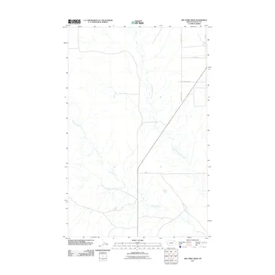
2011 Map of Dry Fork Creek
USGS Topo · Published 2011About this map
Dry Fork Creek and the West Fork Porcupine Creek define the drainage of this Valley County landscape. This 2011 survey by the U.S. Geological Survey illustrates a sparsely populated section of the Montana prairie, where the terrain is marked more by its natural hydrology than by dense settlement. The rural character of the region is evident in the straightforward grid of county routes, including Golden Valley Rd and Fuhrman Rd, which provide access across the open ranching or farming country. Unlike more developed quads, this area remains dominated by its namesake watercourse and the surrounding topography. Local family names or ranching history are echoed in smaller roads like W Meadowlark Rd and Elde Rd, providing specific geographic markers for genealogists or land researchers focused on this northeastern Montana district.
Find a feature on this map
7 named features on this map. Tap any name to fly to it.
Don’t see what you’re looking for? This feature index may not catch every label — zoom into the map to look around manually.
Map Details
Editions of this 2011 Dry Fork Creek Map
This is the sole edition of this map. No revisions or reprints were ever made.
Other maps of this area

1918 · Porcupine Valley
USGS Topo · 1:62,500

1919 · Boundary
USGS Topo · 1:125,000

1943 · Glasgow
USGS Topo · 1:125,000

1954 · Glasgow
USGS Topo · 1:250,000

1957 · Glasgow
USGS Topo · 1:250,000

1958 · Glasgow
USGS Topo · 1:250,000

1969 · Cornwell Reservoir
USGS Topo · 1:24,000

1969 · Chapman Coulee NE
USGS Topo · 1:24,000

1973 · Baylor
USGS Topo · 1:24,000

1973 · Cameron Point
USGS Topo · 1:24,000