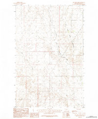
1984 Map of Dry Fork Creek
USGS Topo · Published 1984About this map
The Fort Peck Indian Reservation dominates the eastern landscape of this 1984 provisional survey, its boundary line traversing the drainage basins of Valley County. This area of eastern Montana is defined by the wandering paths of Dry Fork Creek and the West Fork Porcupine Creek, where the terrain is marked by intricate contour intervals of 10 feet. The map captures a moment in the mid-1970s and early 1980s when the landscape remained largely defined by its natural watercourses and the Indefinite Boundary of the reservation, showing a sparsely settled region primarily shaped by the geography of these significant creek systems. Researchers can trace the fine-grained topographic detail of the draws and ridges that feed into the larger Missouri River watershed.
Find a feature on this map
5 named features on this map. Tap any name to fly to it.
Don’t see what you’re looking for? This feature index may not catch every label — zoom into the map to look around manually.
Map Details
Editions of this 1984 Dry Fork Creek Map
This is the sole edition of this map. No revisions or reprints were ever made.
Other maps of this area

1918 · Porcupine Valley
USGS Topo · 1:62,500

1919 · Boundary
USGS Topo · 1:125,000

1943 · Glasgow
USGS Topo · 1:125,000

1954 · Glasgow
USGS Topo · 1:250,000

1957 · Glasgow
USGS Topo · 1:250,000

1958 · Glasgow
USGS Topo · 1:250,000

1969 · Cornwell Reservoir
USGS Topo · 1:24,000

1969 · Chapman Coulee NE
USGS Topo · 1:24,000

1973 · Baylor
USGS Topo · 1:24,000

1973 · Cameron Point
USGS Topo · 1:24,000