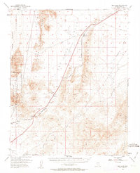
1952 Map of Dry Lake
USGS Topo · Published 1963About this map
The Dry Lake (Depression) defines this high-desert basin, where the industrial and military infrastructure of the early Cold War era is etched into the landscape. This 1952 survey highlights the critical transportation corridor formed by the Union Pacific railroad and the Arrowhead Trail, which serve a string of utility and industrial outposts like Arrolime, Garnet, and Apex. At Apex, the presence of an Apex Underpass and an Airway Beacon underscores the importance of this pass for both rail and air navigation.
Find a feature on this map
20 named features on this map. Tap any name to fly to it.
Don’t see what you’re looking for? This feature index may not catch every label — zoom into the map to look around manually.
Map Details
Editions of this 1952 Dry Lake Map
2 editions found
Other maps of this area

1886 · Saint Thomas
USGS Topo · 1:250,000

1893 · Saint Thomas
USGS Topo · 1:250,000

1907 · Las Vegas
USGS Topo · 1:250,000

1908 · Las Vegas
USGS Topo · 1:250,000

1926 · Boulder Canyon
USGS Topo · 1:96,000

1945 · Sheep Range
USGS Topo · 1:125,000

1952 · Gass Peak
USGS Topo · 1:62,500

1952 · Dry Lake
USGS Topo · 1:62,500

1952 · Henderson
USGS Topo · 1:62,500

1952 · Las Vegas
USGS Topo · 1:62,500