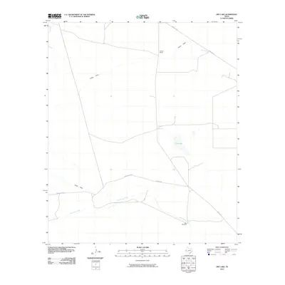
2010 Map of Dry Lake
USGS Topo · Published 2010About this map
Derrick Ranch and other remote outposts define this corner of Reeves County, where the high desert landscape is etched by intermittent watercourses and the infrastructure of West Texas ranching. The namesake Dry Lake is a prominent topographic feature in the eastern half of the map, situated among a network of rural routes including Ranch Rd 2119 and Brooks-Pecos Rd. The survival of the few named settlements here depends on water management, evidenced by the Juan Windmill located along the southern reaches of Cottonwood Creek. Drainages such as Incline Draw and Dutch Draw reveal the area's natural drainage patterns, illustrating how terrain and limited water sources dictate the placement of roads and homesteads across this expansive ranching territory.
Find a feature on this map
9 named features on this map. Tap any name to fly to it.
Don’t see what you’re looking for? This feature index may not catch every label — zoom into the map to look around manually.
Map Details
Editions of this 2010 Dry Lake Map
This is the sole edition of this map. No revisions or reprints were ever made.
Other maps of this area

1921 · Toyah
USGS Topo · 1:125,000

1928 · Kent
USGS Topo · 1:125,000

1954 · Van Horn
USGS Topo · 1:250,000

1954 · Pecos
USGS Topo · 1:250,000

1957 · Pecos
USGS Topo · 1:250,000

1958 · Van Horn
USGS Topo · 1:250,000

1968 · Threemile Draw
USGS Topo · 1:24,000

1968 · W T Ranch
USGS Topo · 1:24,000
1970 · Toyah NW
USGS Topo · 1:24,000

1973 · Rustler Hills
USGS Topo · 1:24,000