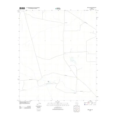
2012 Map of Dry Lake
USGS Topo · Published 2012About this map
Derrick Ranch serves as a primary marker of settlement in this arid reach of West Texas, where the landscape is defined by the intermittent flow of Cottonwood Cr and Dutch Draw. The eponymous Dry Lake sits centrally on the sheet, illustrating the ephemeral nature of water sources in Reeves County. This cattle-ranching territory is navigated via a network of local thoroughfares including Brooks-Pecos Rd, Gresham Rd, and Ranch Road 2119. The presence of the Juan Windmill highlights the vital role of groundwater extraction for sustaining life and livestock in this sparse environment, providing a specific point of interest for researchers studying the history of West Texas water management and land use.
Find a feature on this map
8 named features on this map. Tap any name to fly to it.
Don’t see what you’re looking for? This feature index may not catch every label — zoom into the map to look around manually.
Map Details
Editions of this 2012 Dry Lake Map
This is the sole edition of this map. No revisions or reprints were ever made.
Other maps of this area

1921 · Toyah
USGS Topo · 1:125,000

1928 · Kent
USGS Topo · 1:125,000

1954 · Van Horn
USGS Topo · 1:250,000

1954 · Pecos
USGS Topo · 1:250,000

1957 · Pecos
USGS Topo · 1:250,000

1958 · Van Horn
USGS Topo · 1:250,000

1968 · Threemile Draw
USGS Topo · 1:24,000

1968 · W T Ranch
USGS Topo · 1:24,000
1970 · Toyah NW
USGS Topo · 1:24,000

1973 · Rustler Hills
USGS Topo · 1:24,000