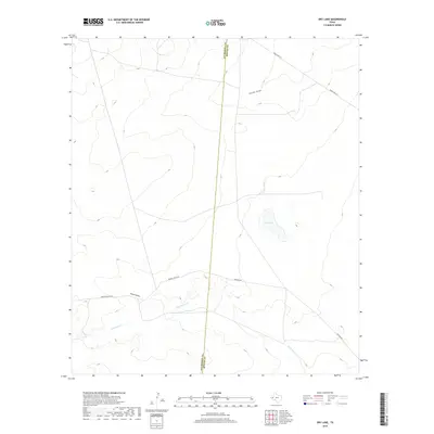
2019 Map of Dry Lake
USGS Topo · Published 2019About this map
Dry Lake sits at the heart of this West Texas landscape along the county boundary separating Culberson and Reeves counties. This 2019 survey captures the arid hydrology of the Trans-Pecos region, where ephemeral drainage patterns like Dutch Draw and Incline Draw define the topography. The sparse road network, including Brooks-Pecos Rd and Gresham Rd, provides the primary access points through this remote ranching territory. Water remains the most significant geographical factor here, with Cottonwood Cr winding through the southern portion of the quadrangle. The map is a vital record for understanding the modern distribution of resources and land boundaries in a corner of Texas where the landscape is dictated by the availability of seasonal water and long-distance transit corridors.
Find a feature on this map
8 named features on this map. Tap any name to fly to it.
Don’t see what you’re looking for? This feature index may not catch every label — zoom into the map to look around manually.
Map Details
Editions of this 2019 Dry Lake Map
This is the sole edition of this map. No revisions or reprints were ever made.
Other maps of this area

1921 · Toyah
USGS Topo · 1:125,000

1928 · Kent
USGS Topo · 1:125,000

1954 · Van Horn
USGS Topo · 1:250,000

1954 · Pecos
USGS Topo · 1:250,000

1957 · Pecos
USGS Topo · 1:250,000

1958 · Van Horn
USGS Topo · 1:250,000

1968 · Threemile Draw
USGS Topo · 1:24,000

1968 · W T Ranch
USGS Topo · 1:24,000
1970 · Toyah NW
USGS Topo · 1:24,000

1973 · Rustler Hills
USGS Topo · 1:24,000