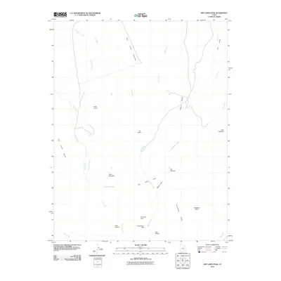
2010 Map of Dry Lakes Peak
USGS Topo · Published 2010About this map
Dry Lakes Peak stands as the central topographic focal point in this high-elevation corner of Garfield County, where the landscape is defined by a complex drainage system of washes and creeks. The hydrology of the area is shaped by the descent of Cottonwood Creek and Birch Creek through specialized terrain features such as The Narrows and the Dry Lakes Area. These watercourses carve through prominent plateaus and rises, including Table Mountain and the Blue Valley Benches, revealing a remote environment used for seasonal transit and livestock, as suggested by names like Rock Corral and Cottonwood Pass.
Find a feature on this map
25 named features on this map. Tap any name to fly to it.
Don’t see what you’re looking for? This feature index may not catch every label — zoom into the map to look around manually.
Map Details
Editions of this 2010 Dry Lakes Peak Map
This is the sole edition of this map. No revisions or reprints were ever made.
Other maps of this area

1885 · San Rafael
USGS Topo · 1:250,000

1952 · Mount Ellen 4 SW
USGS Topo · 1:24,000

1952 · Mt. Ellen 4 NW
USGS Topo · 1:24,000

1952 · Bull Mountain
USGS Topo · 1:62,500

1954 · Mt. Ellen 2 SE
USGS Topo · 1:24,000

1954 · Mt. Ellen 2 SW
USGS Topo · 1:24,000

1954 · Mt. Ellen 1 SW
USGS Topo · 1:24,000

1954 · Factory Butte
USGS Topo · 1:62,500

1956 · Salina
USGS Topo · 1:250,000

1960 · Salina
USGS Topo · 1:250,000