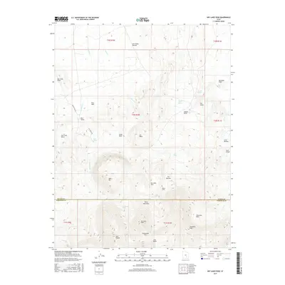
2017 Map of Dry Lakes Peak
USGS Topo · Published 2017About this map
Dry Lakes Peak stands as a central landmark in this high-altitude landscape where the Henry Mountains dominate the southern topography. The terrain is defined by a series of dramatic geological features, including the Bacon Slide, Jet Basin, and the deeply incised The Narrows. Water sources are critical points in this arid environment, marked by numerous named springs such as Lost Spring, Willow Spring, and Dugout Bench Spring. The map documents a sparsely settled area where names like Deer Heaven and Little Meadow suggest historical grazing or hunting grounds among the canyons and benches.
Find a feature on this map
46 named features on this map. Tap any name to fly to it.
Don’t see what you’re looking for? This feature index may not catch every label — zoom into the map to look around manually.
Map Details
Editions of this 2017 Dry Lakes Peak Map
This is the sole edition of this map. No revisions or reprints were ever made.
Other maps of this area

1885 · San Rafael
USGS Topo · 1:250,000

1952 · Mount Ellen 4 SW
USGS Topo · 1:24,000

1952 · Mt. Ellen 4 NW
USGS Topo · 1:24,000

1952 · Bull Mountain
USGS Topo · 1:62,500

1954 · Mt. Ellen 2 SE
USGS Topo · 1:24,000

1954 · Mt. Ellen 2 SW
USGS Topo · 1:24,000

1954 · Mt. Ellen 1 SW
USGS Topo · 1:24,000

1954 · Factory Butte
USGS Topo · 1:62,500

1956 · Salina
USGS Topo · 1:250,000

1960 · Salina
USGS Topo · 1:250,000