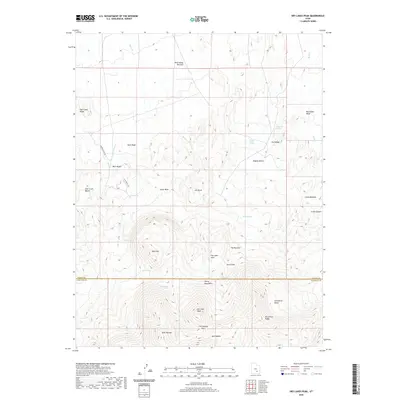
2020 Map of Dry Lakes Peak
USGS Topo · Published 2020About this map
The Henry Mountains dominate the southern landscape of this quadrangle, rising toward the prominent Dry Lakes Peak and the surrounding Dry Lakes Area. This high-elevation terrain is marked by notable geological formations and named points such as Table Mtn and Horseshoe Ridge, which transition into lower desert washes and benches to the north. The area's water resources are evidenced by numerous isolated springs, including Side Hill Springs, Oak Spring, and Birch Spring, which historically served as critical markers for travel and livestock in this arid environment.
Find a feature on this map
41 named features on this map. Tap any name to fly to it.
Don’t see what you’re looking for? This feature index may not catch every label — zoom into the map to look around manually.
Map Details
Editions of this 2020 Dry Lakes Peak Map
This is the sole edition of this map. No revisions or reprints were ever made.
Other maps of this area

1885 · San Rafael
USGS Topo · 1:250,000

1952 · Mount Ellen 4 SW
USGS Topo · 1:24,000

1952 · Mt. Ellen 4 NW
USGS Topo · 1:24,000

1952 · Bull Mountain
USGS Topo · 1:62,500

1954 · Mt. Ellen 2 SE
USGS Topo · 1:24,000

1954 · Mt. Ellen 2 SW
USGS Topo · 1:24,000

1954 · Mt. Ellen 1 SW
USGS Topo · 1:24,000

1954 · Factory Butte
USGS Topo · 1:62,500

1956 · Salina
USGS Topo · 1:250,000

1960 · Salina
USGS Topo · 1:250,000