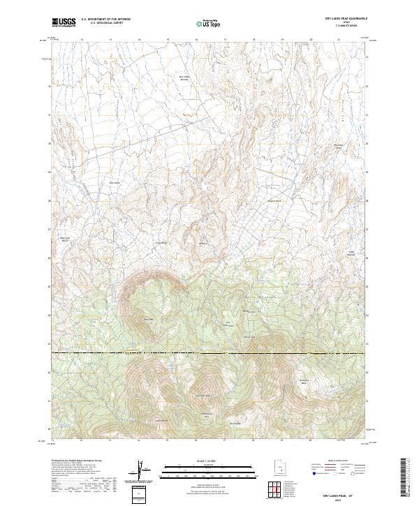
2023 Map of Dry Lakes Peak
USGS Topo · Published 2023About this map
The Henry Mountains dominate this high-elevation landscape along the border of Wayne and Garfield Counties. This 2023 survey reveals a complex terrain of dramatic verticality, where the massive Table Mtn and the namesake Dry Lakes Peak rise above surrounding basins and washes. Navigability in this high country is limited to a few specific corridors like Jackson Pond Rd and Lost Spring Rd, which skirt the steep ridges and benches. The map captures a topography defined by erosion and exposure, with features like Bacon Slide and Jet Basin indicating the geological forces at work. Life in this arid environment clusters around scarce water sources such as Birch Spring, Willow Spring, and the high mountain meadows at Deer Heaven, reflecting the historic reliance on seasonal water for livestock and travel in the Utah backcountry.
Find a feature on this map
37 named features on this map. Tap any name to fly to it.
Don’t see what you’re looking for? This feature index may not catch every label — zoom into the map to look around manually.
Map Details
Editions of this 2023 Dry Lakes Peak Map
This is the sole edition of this map. No revisions or reprints were ever made.
Other maps of this area

1885 · San Rafael
USGS Topo · 1:250,000

1952 · Mount Ellen 4 SW
USGS Topo · 1:24,000

1952 · Mt. Ellen 4 NW
USGS Topo · 1:24,000

1952 · Bull Mountain
USGS Topo · 1:62,500

1954 · Mt. Ellen 2 SE
USGS Topo · 1:24,000

1954 · Mt. Ellen 2 SW
USGS Topo · 1:24,000

1954 · Mt. Ellen 1 SW
USGS Topo · 1:24,000

1954 · Factory Butte
USGS Topo · 1:62,500

1956 · Salina
USGS Topo · 1:250,000

1960 · Salina
USGS Topo · 1:250,000