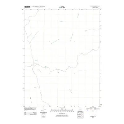
2011 Map of Dry Mesa
USGS Topo · Published 2011About this map
Dry Mesa and the expansive drainage systems of the San Rafael Desert dominate this arid corner of Emery County. The landscape is defined by a network of seasonal watercourses, including the extensive Summerville Wash and its Middle Fork and Left Fork. These intermittent streams carved the terrain long before modern infrastructure arrived, leaving behind deep landmarks like Joe Hole Wash and Big Hole Wash. In a region where water is the primary concern, small human interventions are visible through the presence of Saleratus Reservoir and Smith Pond. Transportation through this isolated territory is maintained by remote corridors such as Green River Cutoff Rd and Cottonwood Wash Rd, which navigate around the high ground of Horse Heaven to connect the desert interior with the wider region.
Find a feature on this map
12 named features on this map. Tap any name to fly to it.
Don’t see what you’re looking for? This feature index may not catch every label — zoom into the map to look around manually.
Map Details
Editions of this 2011 Dry Mesa Map
This is the sole edition of this map. No revisions or reprints were ever made.
Other maps of this area

1886 · Price River
USGS Topo · 1:250,000

1896 · Price River
USGS Topo · 1:250,000

1948 · Woodside
USGS Topo · 1:62,500

1949 · Woodside
USGS Topo · 1:62,500

1950 · Woodside
USGS Topo · 1:62,500

1953 · Red Plateau SE
USGS Topo · 1:24,000

1953 · Beckwith Peak SW
USGS Topo · 1:24,000

1956 · Price
USGS Topo · 1:250,000

1960 · Price
USGS Topo · 1:250,000

1962 · Price
USGS Topo · 1:250,000